Downloads

Here you can find the GPX tracks for your device.
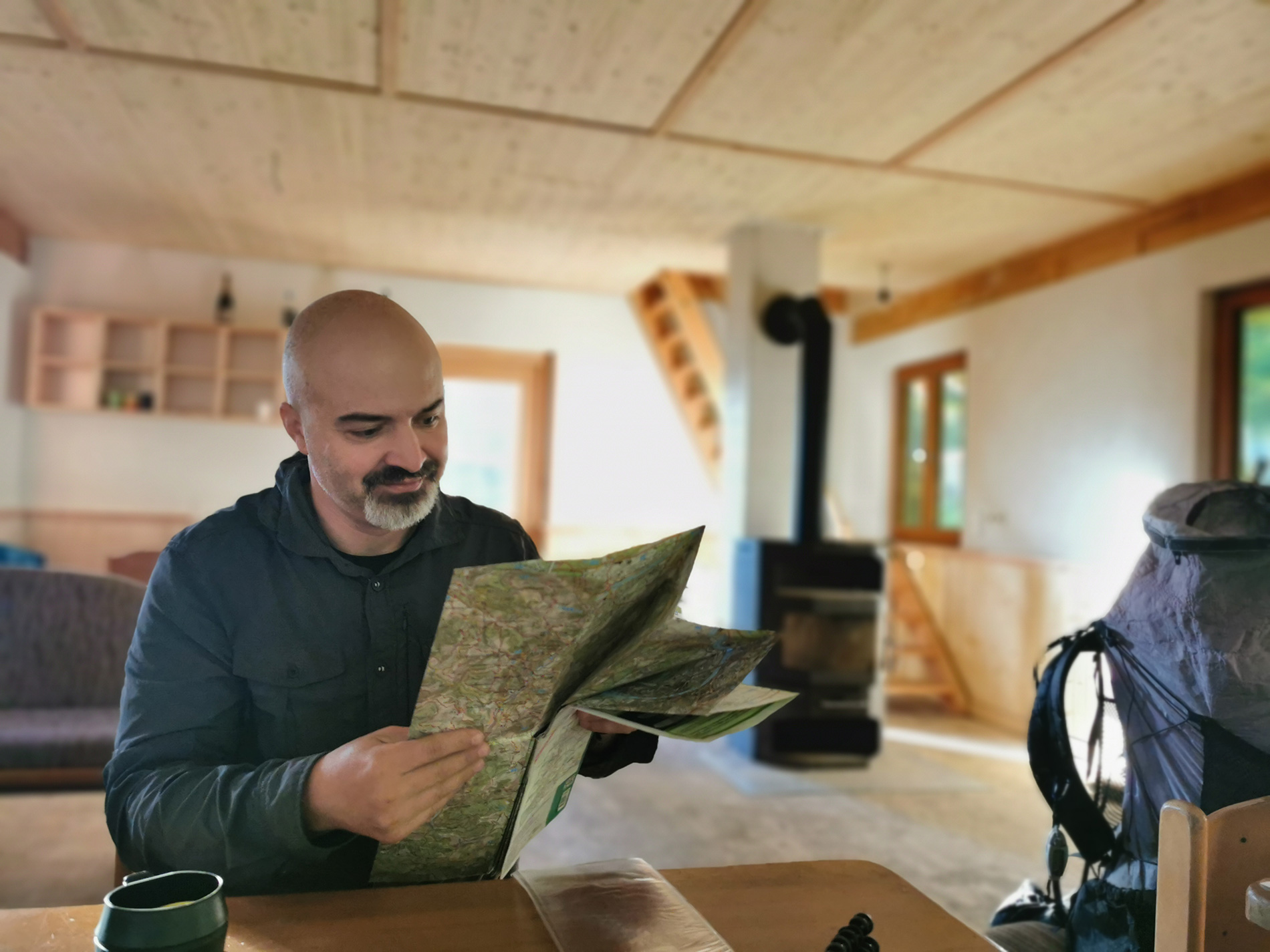
On this page, you can download the official GPX tracks for the North-South Trail (NST) free of charge.Transfer them to your GPS device or smartphone and keep your route in view at all times.
How it works:
- Download the GPX file: Click on the desired section and save the GPX file to your device.
- Transfer to your device: Move the file to your GPS device or smartphone.
- Start navigation: Open the file in your preferred navigation app or software and follow the trail.
If you need help transferring the GPX files or have questions about how to use them, you can find a detailed guide here: Guide: How to open GPX files (Ger)
GPX-Track
Here you can download the entire NST track as a GPX file:
Here you can download the alternative route of the NST as a GPX file. Southern section with the “Soultrails variant” The best of Westweg and Mittelweg:
Because the North-South Trail covers a long distance and contains many waypoints, some devices may experience performance issues. For this reason, the NST has been divided into four clearly structured sections:
North, Central, West, and South.
All corresponding GPX tracks are already included in the download package to ensure smooth navigation along the entire trail.
 Note: Shelters and other POIs (Points of Interest) are not included in these tracks.
If you have any questions, feel free to reach out to us in the Forum – we’re happy to help!
Discover the Highlights along the North-South Trail
The POIs in the Wanderfreund App show you the most beautiful spots, useful stops, and hidden gems along the trail. Whether you’re looking for a water source, planning your overnight stay, or searching for the next scenic viewpoint – with the POIs, you won’t miss a thing.

Wanderfreund—your digital guide on the NST
All POIs (points of interest) listed here, such as shelters and water sources, are now also available in a compact app for use on the go—and best of all, it even works offline.
Additional resources
⚠️Note:
The Resource Map and Interactive Map dof the North-South Trail are only accessible with a stable internet connection. They are especially useful for planning your hike or preparing the next stages during breaks at hotels or other places with reliable network access. Please note that in remote areas without mobile coverage or Wi-Fi, map functionality may be limited.
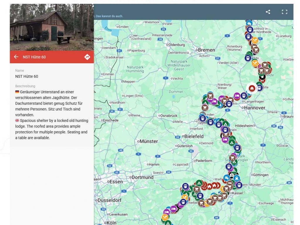
What is the Resource Map?
The Resource Map on the official North-South Trail website is an interactive tool designed to help hikers prepare for their journey and navigate more easily while on the trail. It provides a wealth of valuable information that goes beyond the features available in the Wanderfreund App – including numerous photos and detailed descriptions of various Points of Interest (POIs) along the route.
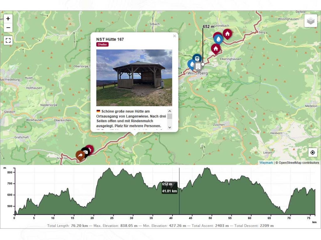
What Can the Interactive Map Do?
The interactive map of the North-South Trail is far more than just an overview – it’s directly linked to detailed descriptions of each section of the trail. This combination of map and route information makes it an incredibly powerful planning tool. You can view start and end points, distance, difficulty level, and elevation profiles at a glance. Each stage of the NST is clickable on the map, giving you instant access to its corresponding route description.
Paid alternative
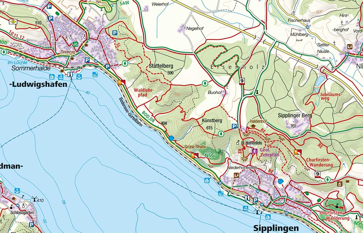
Kompass Maps – Official Digital North South Trail Map
We’re excited to offer you the complete North-South Trail map as a digital version from Kompass Karten GmbH. This digital map includes the full course of the trail with all major sections, elevation profiles, and trail markings.
Note: Access to this digital map requires a paid subscription.
The KOMPASS PRO version costs €24.99 per year or €2.08 per month (no auto-renewal, no commitment – memberships purchased on the website end automatically after the chosen duration).
What is Kompass Karten GmbH?
Kompass Karten GmbH is one of Europe’s leading providers of hiking, cycling, and leisure maps, known for its precise cartography and reliable outdoor data for decades. Through its collaboration with the North-South Trail, Kompass now offers digital maps covering the entire route, enabling optimal trip planning.
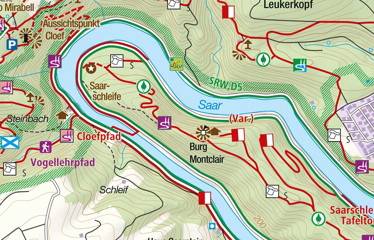
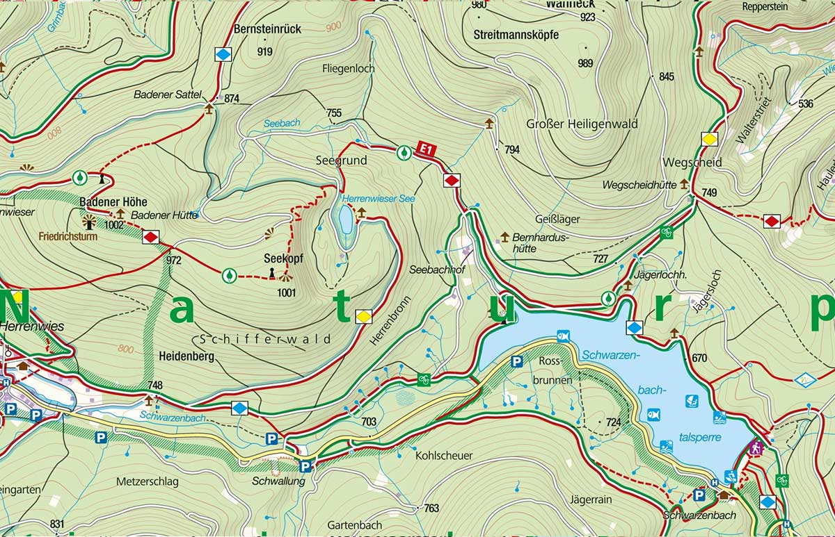
Click to enlarge

The PRO Version Offers You:
- The entire official Nord Süd Trail
- Original KOMPASS cartography
- Offline map and tour storage
- Plan and record your own routes
- GPS positioning, live tracking & location sharing
- Import/export GPS data
- Weather forecasts
- No ads


 for Wordpress and WooCommerce.")