
The Saarland Circular Trail – A new section for the Nord Süd Trail?

The North-South Trail (NST) is designed to link together some of the most beautiful existing hiking routes in Germany. In the very first version of the trail, which Soulboy hiked in 2020, there were still quite a few unmarked sections. Over the years, these gaps have been steadily closed. One such section was the 171 km stretch connecting the NST’s westernmost point, the Saarschleife, to the Palatinate Wine Trail.
During his hike, Soulboy quickly realized that this section needed a serious overhaul—it included too many dull paths running alongside busy main roads.
That’s why it was so encouraging when forum user esha proposed an alternative route. This cut the unmarked portion down to just 40 km before rejoining established hiking trails at Dagstuhl. The connection used the 5-Kreise-Weg, den Panoramaweg St. Wendler Land, a section of the Camino de Santiago, the Veldenz Trail, the Palatinate Heights Trail, and the West Palatinate Trail “Red W” (Celts and Wine). At the time, the Saarland Circular Hiking Trail was briefly considered as part of the route—but quickly dismissed. Here, I’d like to explain why I’m bringing this trail back into consideration as a possible addition to the NST.

I personally hiked the NST in 2022, and it was an incredibly beautiful and formative experience. I was particularly fond of the western tangent, which included the Saar-Hunsrück Trail and the other routes mentioned above.
It must have been near the Hunnenring at Otzenhausen when I first noticed a red-and-white square trail marker with the words Saarland-Rundwanderweg. on it. The idea of a trail that circles an entire (and very scenic) federal state intrigued me. I immediately added it to my “someday” hiking list.
The Saarland Circular Hiking Trail came back onto my radar at Easter 2024, when my partner Luise, my friend Bryce, and I hiked the Bliessteig Saarland had already left its mark on me as a hiking destination, so when I learned that the Bliessteig—a richly certified premium trail and, quite deservedly, a nominee for Germany’s Most Beautiful Hiking Trail this year—shared about 50 absolutely gorgeous kilometers with the Saarland Circular Trail, the decision was easy.
When it later became clear that I’d have time in the summer for a longer hike, the choice naturally fell on the now very present Saarland Circular Trail. While preparing, I realized that it could provide a fully marked connection from the Saarschleife to St. Wendel for the NST. That settled it: I had to test it thoroughly for its NST suitability!
The Saarland Circular Hiking Trail is officially a 273 km loop that roughly follows the border of Saarland. It starts and ends in the state capital, Saarbrücken—though without a notable trailhead. Established in 1975, the route was given a major overhaul in 2015, and possibly again afterward. The official GPX track actually measures exactly 300 km. In addition, there are three optional loops: the 60 km Bliesgau Loop, the 42 km Moselgau Loop, and the 25 km St. Wendel Loop. Hike them all, and you’ll be covering an impressive total of 427 km!

I began my hike on the Saarland Circular Hiking Trail (Saarland-Rundwanderweg) on July 30, 2024, starting in Mettlach and heading clockwise. This way, I could save the Saarschleife as the grand finale of my journey. In the northern part of Saarland, the trail runs almost entirely parallel to the Saar-Hunsrück Trail—and therefore also the NST! It felt amazing to be back on it. Even though I was now walking in the opposite direction, I recognized many familiar spots and could clearly remember what it had been like to pass through them two years earlier.
Here, the route took me along beautiful paths—whenever possible, on narrow singletrack trails. Overall, the Saar-Hunsrück Trail has only about 5% paved sections. My first overnight stop was NST Hut 364, right next to the Trail Magic station at Rehbrunnen. Unfortunately, I made a grim discovery there: I had forgotten to bring a lighter. That meant no hot meal and an empty stomach—hardly ideal when your entire food supply consists of things that require cooking. I didn’t manage to cook until the next day, when I found a lighter in the lovely hikers’ hut in Reidelbach.
Freshly fueled, I left the NST behind for now, as the Saarland Circular Trail skipped the loop to Grimburg and instead climbed steeply toward Schreck, taking a more direct route to the Hunnenring at Otzenhausen. By the time I reached it in the evening after 38 km, I was completely wiped out—but it was worth it. The Hunnenring had been one of my absolute favorite spots on the NST, and now I got to experience another sunset atop those ancient stone walls. I wasn’t disappointed.

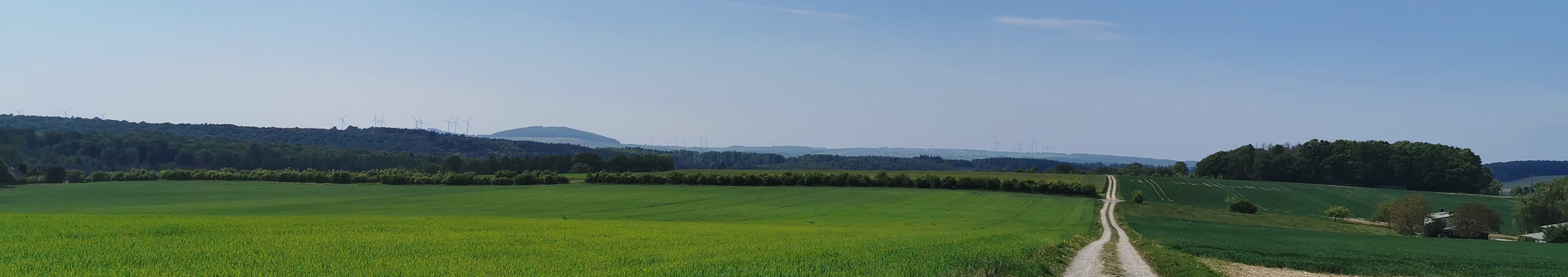
At this point, the Saarland Circular Trail fully diverged from the NST. Accompanied by unstable weather and frequent thunderstorms, I made my way deeper into the St. Wendel region. This section was exactly as I had imagined it: a cultural landscape of gently rolling hills and sweeping panoramas. The high proportion of paved roads didn’t bother me at all—just as it hadn’t two years earlier on the NST.
When I arrived in Güdesweiler and stopped at the cemetery to refill my water, the sky suddenly opened up. It was one of the heaviest downpours I’d experienced in years. At first, I sheltered under a small awning by the cemetery chapel, but before long I spotted my night’s accommodation: a hikers’ hut maintained by the local hiking club.
The next morning, I reached St. Wendel and took a long break in the beautiful basilica in the town center.
My timing was perfect—someone was playing the organ in full force.
From St. Wendel, the trail took on a new significance for me. From here on, I was hiking the potential new NST route. This was the real test: Could the Saarland Circular Trail maintain its quality? The climb out of town was steep—matching the elevation gain of the northern section. There were still fantastic views, including one last great look back at St. Wendel.
The first checkpoint for NST suitability came quickly: a shelter hut. These need to appear regularly along the route. This one ticked the box. The next checkpoint came in the very next village, Fürth—a cemetery with potable water. Another tick. Even better: the trail here was genuinely enjoyable.
With distant thunder rumbling, I reached my target shelter for the evening: the Spitzbubenhütte, where I had slept back at Easter while on the Bliessteig. The storms passed, and I was treated to a spectacular sunset. I can recommend this hut to anyone—whether they’re on the Saarland Circular Trail, the Bliessteig, or one day the NST.
Of course, future NST hikers would arrive from the opposite direction, which might be even better. That way, they could make stops at the Höcherbergturm (complete with a soda vending machine) and the Münchweiler cemetery (drinking water, toilets, and accessible power outlets).


From there, I continued on the Bliessteig through the stunning Saarpfalz region. If I had to choose one section of the Saarland Circular Trail worthy of becoming part of the NST, it would be this one! I’d estimate about 80% of it is narrow singletrack, winding through a beautiful, diverse, and healthy forest. There are constant views, and the route is dotted with staffed huts run by the Palatinate Forest Association. It’s a dream—and the hiking infrastructure here easily rivals the Black Forest or the Rheinsteig.
That night, I camped in a hidden corner of the Hohenburg castle ruins near Homburg. In theory, a fantastic location—except for two drawbacks: the place was busy until late at night, and the ground was crawling with slugs, which decided to crawl over me while I slept. The next day’s trail more than made up for it, though. The stretch from Homburg to Kirkel is perhaps the most beautiful I’ve ever walked: a unique, several-kilometer-long singletrack through a green tunnel. At times you can only see three meters ahead or behind you—just trees in all directions. The path hugs the slope, with no view of the valley floor below and tree cover above, broken only occasionally by red sandstone cliffs. I’d go so far as to say the entire Saarland Circular Trail is worth hiking just for this section.
After a zero day at the wonderful Kirkeler Naturfreundehaus (which I can’t recommend highly enough), I continued toward Saarbrücken and the French border. I have to compare this next section to the Rheinsteig—though not entirely in a positive way. The paths were still fantastic—narrow and scenic—but often within earshot of the A6 motorway. It’s a bit like the Rhine Valley, where the constant sound of trains is your background music.
Still, there was another highlight: in the Saarbrücken city forest stands the 41 m high Schwarzenberg Tower, offering views all the way to the Vosges mountains. Like the E1 in Hamburg, the NST passes through Saarbrücken on the greenest possible route. In the adjacent St. Arnual city forest, I left the trail, crossed the border, and spent the night in a wonderful French-side shelter with a spectacular view. Another recommendation—this might be the best spot for NST hikers to camp on French soil.

The trail next led me through the Warndt, offering deep views into the Saar Valley. The Warndt is a vast forest area with an impressively diverse and intact tree population. Unfortunately, many of the paths here were wide forestry roads rather than narrow trails. Still, my enjoyment of the massive oaks, Douglas firs, and beeches was undiminished. At this point, Bryce joined me, accompanying me for the final days. Together, we experienced an unforgettable evening. At a remote barbecue hut near Ludweiler, we witnessed something truly special: during steel production at the Völklingen Ironworks, slag has to be poured off regularly. When this happens in the evening hours, it glows bright orange—just like a sunset—but only for a brief moment. The entire spectacle lasts barely a minute. I hope that everyone walking this trail gets to witness such a sight. This phenomenon perfectly reflects the unique charm of the area: here, peaceful, untouched nature meets heavy industry. The contrast is one-of-a-kind in Germany and feels straight out of a Studio Ghibli film. You really have to see it with your own eyes.
Between the Warndt and the Saar Loop lies a region that might divide the hiking community—the Saargau, often called the breadbasket of Saarland. Much like the St. Wendel region, it’s a gently rolling landscape of hills. We often walked on asphalt here, but the sweeping views over golden grain fields and gnarled old orchards stretching into Lorraine made it worthwhile. To me, it’s a very special landscape. Once again, we found an incredible sleeping spot—the Siersburg. Perched high above the surrounding land (and not located in a nature reserve), it offers almost a 360° view. On one side, the sun set behind wooded hills; on the other, we looked deep into the Saar Valley. Once again, we saw the striking contrast between wild nature and heavy industry. The next morning brought the most beautiful sunrise of my hiking life.


The Saar Loop was now within reach. Crossing the last stretches of the Saargau, we re-entered the Hunsrück. Suddenly, in the Nackberg Nature Reserve—one of the oldest in the country—I could see the hills and mountains I had crossed two weeks earlier on the Saarland Circular Trail, and two years before that on the NST. Spots like these are important on long trails: they invite you to pause, reflect, and process your journey. For our final night, we stayed at the shelter atop the Cloef viewpoint, overlooking the Saar Loop. Here we met Mo, who was hiking the NST in 2024. Even though our sleep was interrupted several times during the night, it was the perfect ending to my hike on the Saarland Circular Trail.
If you want to hear more about my experiences on this trail, I recommend the Trail Correspondents podcast series from Wanderwach und Kaffee. I reported live and in detail from the trail there—sometimes it was far more exhausting and chaotic than I’ve been able to sum up here. Definitely give it a listen.So, what’s my final verdict on the Saarland Circular Trail? Does it have what it takes to become part of the NST? In short: yes! The trail offers everything needed: consistent and clear waymarking, plenty of shelters, enough water sources, frequent access to campsites, nature lodges, or hotels, and several resupply options. The hiking infrastructure is spot on. During my trek, I recorded all the necessary data so it can be added to the resource map and shared with the hiking community.But is it enjoyable to hike? Again—a clear yes! There are countless highlights, some of which I’ve already mentioned—yet there’s even more to discover. Of course, a trade-off has to be considered. The section that would be added from the Saarland Circular Trail is 199 km long, while the part it would replace on the NST is only 105 km. The NST would therefore be extended by 94 km. We’d lose highlights such as Montclair Castle, Dagstuhl Castle, the Wortsegel sculpture, the stunning panoramic views from Schaumberg near Tholey, and the entire 5-Districts Trail.But having hiked both routes, my conclusion is clear—it’s worth it! In my opinion, the Saarland Circular Trail offers far more than what we would lose. And it would finally close the last unmarked gap of the NST.
What do you think? Have I convinced you? Do you believe the Saarland Circular Trail would be a meaningful addition to the NST? Share your thoughts in the comments.

If you would like to learn more about my experiences on the Saarland Circular Trail, I recommend the podcast series by the trail correspondents at Wanderwach und Kaffee There, I reported live and in detail about the trail. At times, it was even more strenuous and chaotic than I was able to summarize here. So please feel free to listen in (German language only) :


Post a Comment
You must be logged in to post a comment.
 for Wordpress and WooCommerce.")